Illustrated Bible Maps
Rose Publishing
aug. 2025 · Rose Publishing
E-bok
family_home
Kvalifisert
info
infoDenne boken blir tilgjengelig 19. august 2025. Du blir ikke ikke belastet før den er utgitt.
Om denne e-boken
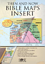
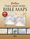
Packed full of fascinating maps, photos, and diagrams, Illustrated Bible Maps shows when and where Bible events happened. More than 100 Bible maps and illustrations will take you chronologically through the Old and New Testaments--from Abraham’s homeland in Mesopotamia to the seven churches of Revelation in Asia Minor.
- See the mountains of Ararat where Noah’s ark came to rest.
- Follow the route of the exodus through the Sinai Peninsula.
- See where David faced Goliath in the Valley of Elah.
- Locate all the places mentioned in the book of Psalms.
- Trace Paul’s missionary journeys across the Mediterranean Sea.
Hvordan lese innhold
Smarttelefoner og nettbrett
Installer Google Play Bøker-appen for Android og iPad/iPhone. Den synkroniseres automatisk med kontoen din og lar deg lese både med og uten nett – uansett hvor du er.
Datamaskiner
Du kan lytte til lydbøker du har kjøpt på Google Play, i nettleseren på datamaskinen din.
Lesebrett og andre enheter
For å lese på lesebrett som Kobo eReader må du laste ned en fil og overføre den til enheten din. Følg den detaljerte veiledningen i brukerstøtten for å overføre filene til støttede lesebrett.