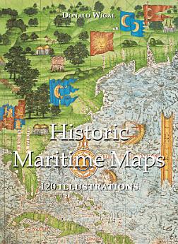
Historic Maritime Maps 120 illustrations
joulu 2022 · Parkstone International
3,5star
2 arvosteluareport
E-kirja
108
sivuja
family_home
Kelvollinen
info
reportArvioita ja arvosteluja ei ole vahvistettu Lue lisää
Tietoa tästä e-kirjasta
In the Middle Ages, navigation relied upon a delicate balance between art and science. Whilst respecting the customs and the precautions of their forbearers, sailors had to count on their knowledge of the stars, the winds, the currents, and even of migratory flights. They also used hand-painted maps, which, although certainly summary, were marvellously well-drawn. In following the saga of old sailors, from Eric Le Rouge to Robert Peary, Donald Wigal leads us in discovering the New World. This magnificent overview of maps dating from the 10th to the 18th centuries, often ‘primitive’ and sometimes difficult to understand, retraces the progress of cartography and shows the incredible courage of men who endeavoured to conquer the seas with tools whose geographical accuracy often left much to be desired.
Arviot ja arvostelut
3,5
2 arvostelua
Arvioi tämä e-kirja
Kerro meille mielipiteesi.
Tietoa lukemisesta
Älypuhelimet ja tabletit
Asenna Google Play Kirjat ‑sovellus Androidille tai iPadille/iPhonelle. Se synkronoituu automaattisesti tilisi kanssa, jolloin voit lukea online- tai offline-tilassa missä tahansa oletkin.
Kannettavat ja pöytätietokoneet
Voit kuunnella Google Playsta ostettuja äänikirjoja tietokoneesi selaimella.
Lukulaitteet ja muut laitteet
Jos haluat lukea kirjoja sähköisellä lukulaitteella, esim. Kobo-lukulaitteella, sinun täytyy ladata tiedosto ja siirtää se laitteellesi. Siirrä tiedostoja tuettuihin lukulaitteisiin seuraamalla ohjekeskuksen ohjeita.