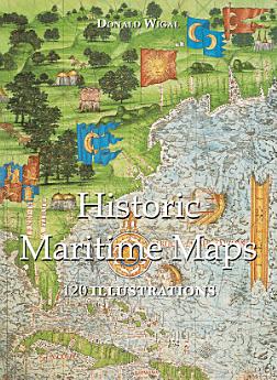
Historic Maritime Maps 120 illustrations
ديسمبر 2022 · Parkstone International
3.5star
مراجعتان (2)report
كتاب إلكتروني
108
صفحة
family_home
مؤهل
info
reportلم يتم التحقّق من التقييمات والمراجعات. مزيد من المعلومات
معلومات عن هذا الكتاب الإلكتروني
In the Middle Ages, navigation relied upon a delicate balance between art and science. Whilst respecting the customs and the precautions of their forbearers, sailors had to count on their knowledge of the stars, the winds, the currents, and even of migratory flights. They also used hand-painted maps, which, although certainly summary, were marvellously well-drawn. In following the saga of old sailors, from Eric Le Rouge to Robert Peary, Donald Wigal leads us in discovering the New World. This magnificent overview of maps dating from the 10th to the 18th centuries, often ‘primitive’ and sometimes difficult to understand, retraces the progress of cartography and shows the incredible courage of men who endeavoured to conquer the seas with tools whose geographical accuracy often left much to be desired.
التقييمات والتعليقات
3.5
مراجعتان (2)
تقييم هذا الكتاب الإلكتروني
أخبرنا ما هو رأيك.
معلومات القراءة
الهواتف الذكية والأجهزة اللوحية
ينبغي تثبيت تطبيق كتب Google Play لنظام التشغيل Android وiPad/iPhone. يعمل هذا التطبيق على إجراء مزامنة تلقائية مع حسابك ويتيح لك القراءة أثناء الاتصال بالإنترنت أو بلا اتصال بالإنترنت أينما كنت.
أجهزة الكمبيوتر المحمول وأجهزة الكمبيوتر
يمكنك الاستماع إلى الكتب المسموعة التي تم شراؤها على Google Play باستخدام متصفح الويب على جهاز الكمبيوتر.
أجهزة القراءة الإلكترونية والأجهزة الأخرى
للقراءة على أجهزة الحبر الإلكتروني، مثل أجهزة القارئ الإلكتروني Kobo، عليك تنزيل ملف ونقله إلى جهازك. يُرجى اتّباع التعليمات المفصّلة في مركز المساعدة لتتمكّن من نقل الملفات إلى أجهزة القارئ الإلكتروني المتوافقة.