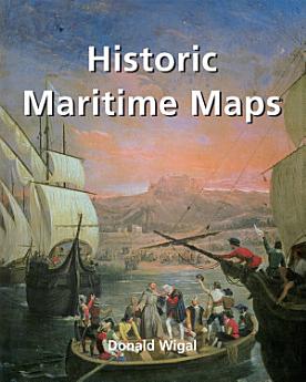
Historic Maritime Maps
2022 පෙබ · Parkstone International
5.0star
සමාලෝචන 1ක්report
ඉ-පොත
256
පිටු
family_home
සුදුසුකම් ලබයි
info
reportඇගයීම් සහ සමාලෝචන සත්යාපනය කර නැත වැඩිදුර දැන ගන්න
මෙම ඉ-පොත ගැන
This book presents a selection of oceanic charts dating from the 13th to the 17th century. Though to us they may appear rudimentary, they bear excellent witness to the achievements of the early European navigators, and to their determination to explore the very ends of the Earth. What the charts may lack in geographical accuracy they undoubtedly make up for in charm. And of course they are priceless historical records. Recounting the epic voyages of maritime exploration, from Erik the Red to Robert Peary, author Donald Wigal leads us on an exciting journey from Terra Incognita to the World As We Know It.
ඇගයීම් සහ සමාලෝචන
5.0
1 සමාලෝචනයක්
මෙම ඉ-පොත අගයන්න
ඔබ සිතන දෙය අපට කියන්න.
කියවීමේ තොරතුරු
ස්මාර්ට් දුරකථන සහ ටැබ්ලට්
Android සහ iPad/iPhone සඳහා Google Play පොත් යෙදුම ස්ථාපනය කරන්න. එය ඔබේ ගිණුම සමඟ ස්වයංක්රීයව සමමුහුර්ත කරන අතර ඔබට ඕනෑම තැනක සිට සබැඳිව හෝ නොබැඳිව කියවීමට ඉඩ සලසයි.
ලැප්ටොප් සහ පරිගණක
ඔබට ඔබේ පරිගණකයේ වෙබ් බ්රව්සරය භාවිතයෙන් Google Play මත මිලදී ගත් ශ්රව්යපොත්වලට සවන් දිය හැක.
eReaders සහ වෙනත් උපාංග
Kobo eReaders වැනි e-ink උපාංග පිළිබඳ කියවීමට, ඔබ විසින් ගොනුවක් බාගෙන ඔබේ උපාංගයට එය මාරු කිරීම සිදු කළ යුතු වේ. ආධාරකරු ඉ-කියවනයට ගොනු මාරු කිරීමට විස්තරාත්මක උදවු මධ්යස්ථාන උපදෙස් අනුගමනය කරන්න.