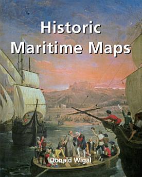
Historic Maritime Maps
02/2022 · Parkstone International
5,0star
1 críticareport
Livro eletrónico
256
Páginas
family_home
Elegível
info
reportAs classificações e as críticas não são validadas Saiba mais
Acerca deste livro eletrónico
This book presents a selection of oceanic charts dating from the 13th to the 17th century. Though to us they may appear rudimentary, they bear excellent witness to the achievements of the early European navigators, and to their determination to explore the very ends of the Earth. What the charts may lack in geographical accuracy they undoubtedly make up for in charm. And of course they are priceless historical records. Recounting the epic voyages of maritime exploration, from Erik the Red to Robert Peary, author Donald Wigal leads us on an exciting journey from Terra Incognita to the World As We Know It.
Classificações e críticas
5,0
1 crítica
Classifique este livro eletrónico
Dê-nos a sua opinião.
Informações de leitura
Smartphones e tablets
Instale a app Google Play Livros para Android e iPad/iPhone. A aplicação é sincronizada automaticamente com a sua conta e permite-lhe ler online ou offline, onde quer que esteja.
Portáteis e computadores
Pode ouvir audiolivros comprados no Google Play através do navegador de Internet do seu computador.
eReaders e outros dispositivos
Para ler em dispositivos e-ink, como e-readers Kobo, tem de transferir um ficheiro e movê-lo para o seu dispositivo. Siga as instruções detalhadas do Centro de Ajuda para transferir os ficheiros para os e-readers suportados.